
I recently developed an innovative and user-friendly Streamlit app for seamless travel planning. The app features a highly interactive geographical map that allows users to easily select points of interest and plan their travels with ease. My needs for a travel app resulted in a solution that is both functional and visually appealing. I am confident that this app will be a valuable tool for anyone looking to plan their travels with confidence.
This app uses the Google Places API and automatically aggregates the geo information for your travel needs. It also uses Google Sheets as a backend making use of their API to access it as well. The data model is based on a user filtering structure that is longitudinal.
To use this app first create a username and enter your location of travel, then enter the places you want to go or put in a generic keyword relating to what you want to do.
Then you will see all of your markers set based on the places you indicated:

If you would like to add more pinpoints in the future simply type your profile username and add more places. (Note anyone can edit your selection for your username)
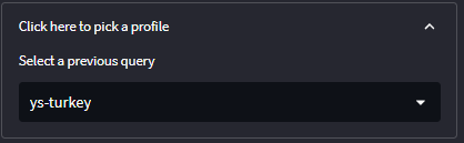
You can also take a look at others selections through the profile selection feature.
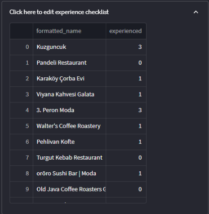
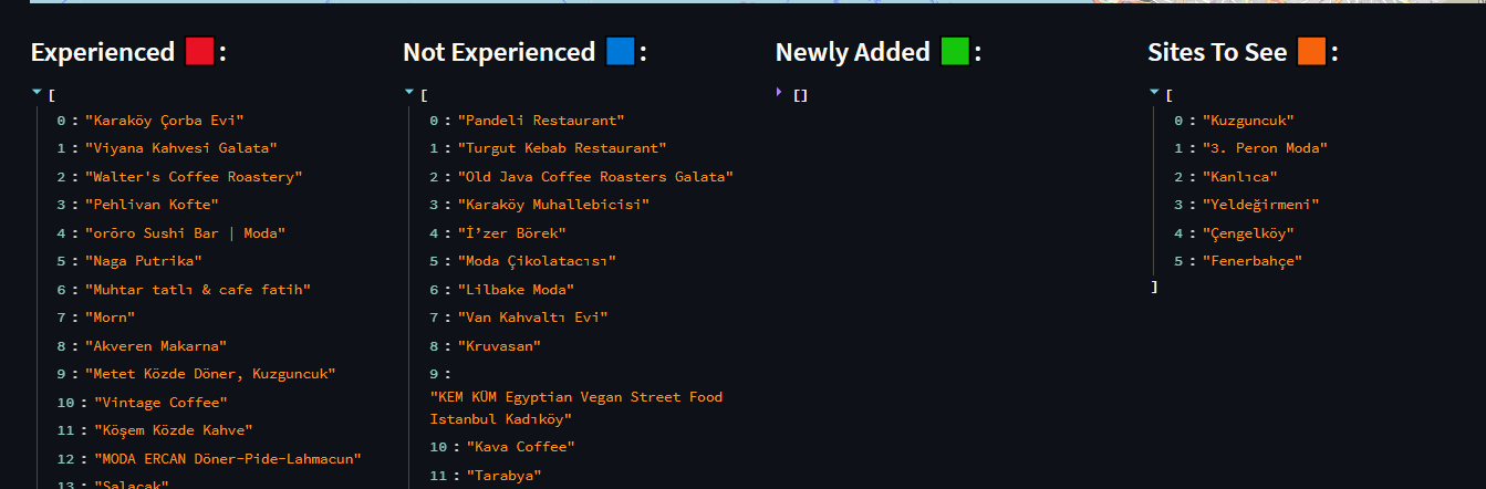
To change the color of the marker, this will help us indicate whether we have went to the specific location. This can be edited here in the experience edit tab by changing the values of the experienced column.
0: Not Experienced [🟦] 1: Experienced [🟥] 2: Newly Added [🟩] 3: Sites to See [🟧]
This will help us understand the different color coding and its contents are also listed at the bottom.
For any questions or additions to this submit a pull request or contact me on LinkedIn!
Deployment: Streamlit App Source: GitHub